Experts say a glacier collapse may have triggered the deadly flash flood near Nepal’s border with Tibet, after satellite imagery showed a large section of glacier and surrounding terrain buried under debris.
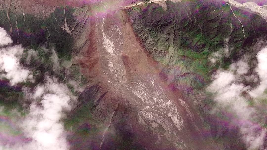
NEW DELHI/LONDON — A deadly flash flood near Nepal’s border with Tibet on Wednesday may have been triggered by the collapse of the lower part of a glacier, which crashed onto the valley floor hundreds of metres below, according to experts who reviewed satellite imagery from Planet Labs.
The disaster has raised concerns about the scale of the destruction, with nearly 170 bodies recovered so far and authorities on both sides fearing the casualty figure could rise. Nearly 1,500 people, including at least 700 foreigners, are reported missing.
Key Highlights
- Experts say a substantial portion of a glacier may have collapsed and triggered the flash flood.
- Satellite imagery showed a previously green mountainside covered by brown debris and sediment after the disaster.
- A warm spell may have melted significant amounts of snow before the event, while the role of climate change remains unclear.
- Nepali authorities described the disaster as an ice-rock avalanche on the Nepali side.
Glacier Collapse May Have Triggered Nepal Flash Flood
Vikram Gupta, an engineering geology specialist who teaches at India’s Sikkim University, said satellite imagery indicated that a substantial portion of the glacier snout had collapsed and likely carried or incorporated considerable rock and sediment.
Dan Shugar, an associate professor at the University of Calgary, said imagery from Planet Labs appeared to show that the lower part of a glacier broke away at about 5,200 metres and fell roughly 1,200 metres to the valley floor.
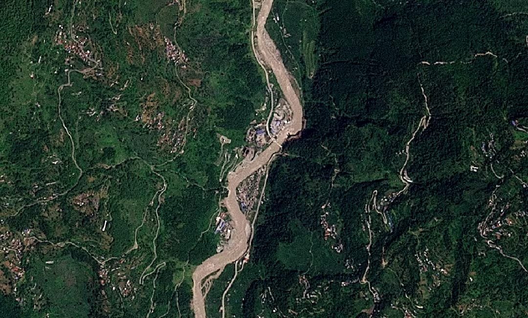
Before-and-after satellite images reviewed by Reuters showed a stark change in the landscape, with a lush green mountainside now covered by brown debris and sediment.
Warm Spell Raises Questions About Glacier Melting
The precise cause of the glacier collapse has not yet been established. Nepali officials had suggested an earthquake in the region as one possibility, but the U.S. Geological Survey later said the reported tremor was actually seismic energy produced by the collapse of glacial rock and ice, followed by debris flow.
Shugar also said the satellite imagery appeared to indicate substantial snowmelt during the 24 hours before the disaster. He pointed to glaciers that had been covered in snow but appeared largely bare of snow afterward, suggesting that temperatures may have been warm.
Whether climate change contributed to the collapse remains unresolved. Shugar said that question, along with the possible role of construction, would require further investigation.
Ice-Rock Avalanche Hit the Affected Area
Nepal’s National Disaster Risk Reduction and Management Authority said the “glacier-inclusive flood” occurred in the Lhende River following a landslide around 20 km northeast of a Nepal-China border crossing.
Prakash Pokharel, a geologist at the authority who reviewed the Planet Labs imagery, described the flash floods as being caused by an ice-rock avalanche on the Nepali side.
Several hydropower projects are located in the worst-affected areas of the mountainous Rasuwa district, which has a population of about 50,000.
Flood Surge Spread Through Major River Systems
The International Centre for Integrated Mountain Development said the flash flood sent a powerful surge of water, sediment and boulders through the Bhote Koshi and Trishuli river systems.
The organisation said water levels at Galchhi downstream reportedly rose by as much as nine metres, or about 30 feet, within 30 minutes.
It also said floods, landslides, avalanches and droughts are becoming more frequent and severe across the Hindu Kush Himalayas, with accelerating changes to water, land and air posing a major threat to communities across the region.
Satellite Imagery to Support Disaster Response
Andrew Zolli, Planet’s chief impact officer, said the company would release fuller imagery under an open licence to support frontline response efforts.
The imagery and expert assessments are expected to help authorities and researchers examine how the glacier collapse, debris movement and flooding were connected. The extent to which warming conditions contributed to the event remains a subject for further scrutiny.
Frequently Asked Questions
What may have triggered the Nepal flash flood?
Experts said a substantial portion of a glacier may have collapsed and crashed onto the valley floor, triggering the deadly flash flood.
How many people are missing?
Nearly 1,500 people, including at least 700 foreigners, are reported missing, while nearly 170 bodies had been recovered.
Was an earthquake responsible for the disaster?
Nepali officials initially pointed to an earthquake as a possibility. The U.S. Geological Survey later said the reported tremor was seismic energy generated by the collapse of glacial rock and ice followed by debris flow.
Did climate change cause the glacier collapse?
The supplied source does not establish climate change as the cause. Experts said a warm spell and rapid snowmelt may have occurred before the disaster, while the climate connection remains unclear.
Disclaimer: This article is for informational purposes only and is based on the supplied source material; readers should consult qualified professionals for personalized advice.

Praveen Yadav is the Founder and Editor at The Nation Bulletin. With over 3 years of experience in digital journalism and news reporting, he covers national affairs, governance, and breaking current events with a commitment to factual accuracy and verified reporting.