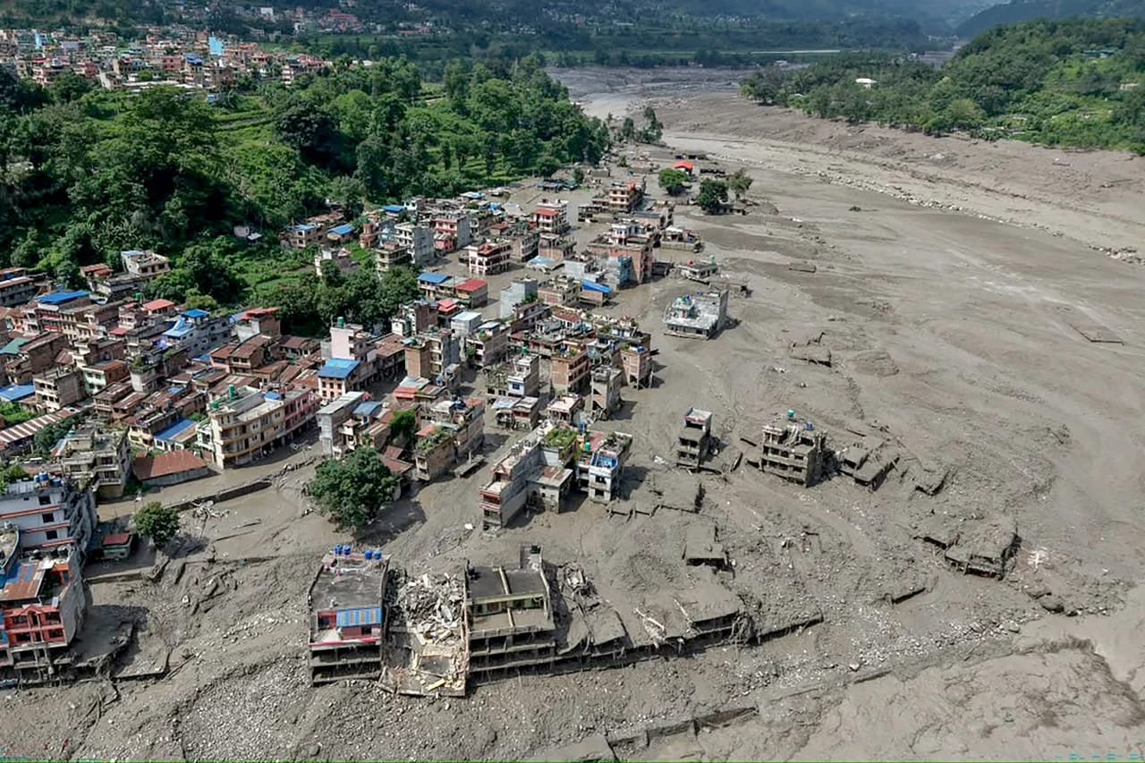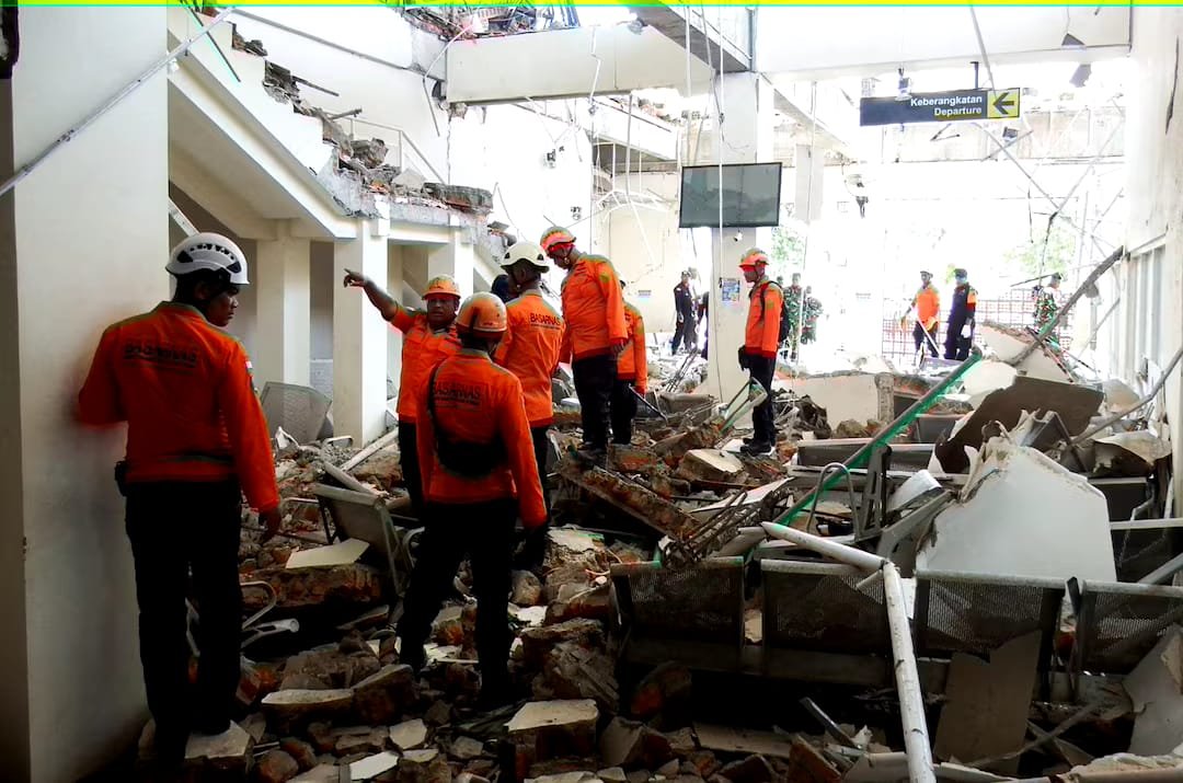
JAKARTA, Indonesia — At least 20 people were killed after a magnitude-7.7 earthquake struck off eastern Indonesia early Saturday, with strong shaking reported across several provinces and rescue teams facing landslides, damaged communications and collapsed structures.
- At least 20 people were reported dead in and around Maumere, according to the local rescue agency.
- Tsunami waves below 1 metre were recorded in several areas before the warning was lifted about three hours later.
- Rescue teams were struggling to reach Nagekeo, the region closest to the epicentre, because of landslides and communication problems.
- The earthquake was followed by several aftershocks after the initial tremor was recorded at a depth of 15 km.
Magnitude-7.7 earthquake hits eastern Indonesia
The earthquake struck at 4:58 a.m. local time, according to Indonesia’s geophysics agency BMKG. The initial quake was recorded at a depth of 15 km, followed by a series of aftershocks.
The powerful shaking was felt across East Nusa Tenggara, West Nusa Tenggara and parts of South Sulawesi. Indonesia’s disaster mitigation agency BNPB said residents in several locations reported shaking that lasted for about a minute.
The quake caused residents to leave their homes as buildings and other structures were affected. Video verified by Reuters from a port in Maumere showed debris falling from a damaged building while people fled into the street.
Rescue teams report 20 deaths in Maumere
Fathur Rahman, head of the rescue agency in Maumere, said rescuers had found 20 people dead, six injured and two others trapped under rubble around the port town.
Maumere is the main town of Sikka Regency on Flores Island in eastern Indonesia. Rescue operations were continuing as authorities assessed the scale of damage in affected communities.
East Nusa Tenggara Governor Emanuel Melkiades Laka Lena told a press conference that at least five people had died after rubble collapsed while they were sleeping.
However, the national disaster mitigation agency initially reported a lower toll of one death and four injuries while saying that it was still collecting information. The differing figures reflected the rapidly developing nature of the rescue operation.
Nagekeo remains difficult to reach after landslides
Rescue teams had not yet reached Nagekeo, the area closest to the earthquake’s epicentre, according to Fathur Rahman. Communication signals in the region had also been affected.
Attempts to travel to Nagekeo by road were blocked by landslides, while another rescue team was attempting to reach the area by ferry.
BNPB said about 2,000 residents in Nagekeo had evacuated. Damage was reported to houses, warehouses and government facilities, while traffic congestion and power outages affected parts of the regency.
The access problems raised challenges for emergency teams seeking to assess damage and reach people who may have been affected by the earthquake and subsequent landslides.
Tsunami warning lifted after waves recorded
The undersea earthquake also prompted a tsunami warning in Indonesia. Waves measuring less than 1 metre were recorded in several areas after the tremor.
The warning was lifted around three hours after the earthquake as authorities continued monitoring coastal areas. Australia’s tsunami warning centre separately said there was no tsunami threat to Australia’s mainland, islands or territories.
The relatively small recorded waves did not remove the need for local authorities to continue assessing coastal and earthquake-related risks as rescue operations proceeded.
Residents describe intense shaking
Residents in affected areas described the earthquake as extremely strong. Nona, a 51-year-old resident of Talibura in East Nusa Tenggara, told Reuters that 13 people were inside her house when the shaking began and that everyone ran outside.
A hospital in Ende district was also seen moving patients outside, according to footage broadcast by Kompas TV. Kompas.com separately reported at least one landslide in the province.
The reports from residents, hospitals and emergency authorities pointed to widespread disruption across parts of East Nusa Tenggara following the early-morning earthquake.
Indonesia’s earthquake risk linked to Ring of Fire
Indonesia sits along the Pacific Ring of Fire, a highly active seismic zone where tectonic plates meet. The region experiences frequent earthquakes and volcanic activity as a result of its geological setting.
BMKG said the same general area had previously experienced a magnitude-7.5 earthquake in 1992, which caused extensive destruction at the time.
The latest earthquake therefore struck a region with a history of significant seismic activity, adding to the challenges faced by communities and emergency services responding to the current disaster.
Rescue and damage assessment continue
Authorities were continuing to collect information on casualties and damage as rescue teams worked across affected areas. The situation remained fluid, particularly in Nagekeo, where landslides and communication disruptions were complicating access.
The immediate priorities included reaching trapped residents, assessing damaged buildings and infrastructure, restoring access routes and monitoring areas affected by the earthquake and aftershocks.
How strong was the Indonesia earthquake?
The earthquake recorded by BMKG had a magnitude of 7.7 and occurred at a depth of 15 km. Several aftershocks were recorded after the initial tremor.
Was there a tsunami after the earthquake?
Tsunami waves of less than 1 metre were recorded in several Indonesian locations. The tsunami warning was lifted about three hours after the earthquake.
Source attribution: This report is based exclusively on the Reuters source material provided for publication, including information attributed to BMKG, BNPB, local rescue authorities and officials.

Praveen Yadav is the Founder and Editor at The Nation Bulletin. With over 3 years of experience in digital journalism and news reporting, he covers national affairs, governance, and breaking current events with a commitment to factual accuracy and verified reporting.